Cropwise imagery
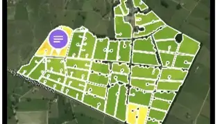
Alongside your SPACE™ reports, Cropwise Imagery provides you with access to high resolution satellite images of your farm wherever you may be. It allows you to monitor and analyse pasture cover and vegetation health across your farm and to help you get the most out of your pasture.
Pasture Vibe
Brings you consistency by “filling in the gaps” with modelled estimates to populate your SPACE™ reports on days where satellites cannot get a usable image due to poor atmospheric conditions or satellite pathing. You can choose how often you want these estimated pasture covers sent to you since your latest viable satellite-based report, ranging from every three to ten days. Modelled estimates are also used in satellite-based reports to estimate readings for paddocks where the dry matter exceeds the accurate estimation range of the satellite. In these instances, satellite data and estimated pasture covers are both integrated within the same report.
Pasture Vibe is a mathematical model that calculates pasture growth using the latest satellite data captured, along with recent paddock growth behaviour and localised environmental conditions and soil characteristics provided by NIWA’s Virtual Climate Network Stations (VCNS). Find out more about Pasture Vibe here.
DairyNZ considers good pasture management a key part of dairy farm profitability. Pasture growth forecasts will help farmers make better decisions on supplementary feeding, grazing rotations, silage making and nitrogen management. Funded by New Zealand dairy farmers through DairyNZ and the Ministry for Primary Industries through the Primary Growth Partnership.


