Within Cropwise Imagery Mobile, navigate into your farm.
- Select ‘Menu’ in the lower-right corner.
- Then select ‘Dashboard’ from the list of available options.
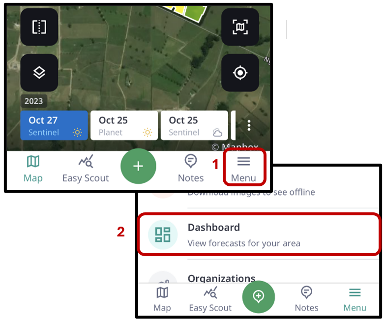
Weather information is displayed based on the location set for your farm. This will provide you with a guide as to when to expect your next clear satellite image.
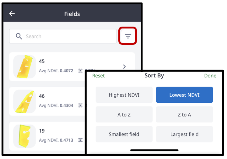
A snapshot is shown of the vegetation health for each paddock on your farm, displaying each as a thumbnail from the most recent satellite image, ordered by Lowest NDVI (default).
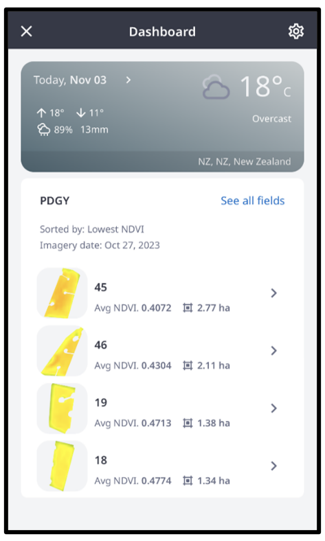
Select ‘See all fields’ to apply alternative ordering of your paddocks to the snapshot.